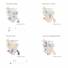
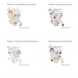
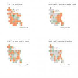
Key measures across districts
What general picture emerges from the data about the CJS for each of the 64 districts across the country? Where are the points of pressure – compared to the national mean? How does the situation in Bangladesh compare to other countries in the region? Each cartogram presents an idealised map of the country divided into its 64 districts. The six (6) metropolitan police and court jurisdictions are identified by a dot . Hover over any district to see data on that district, or dot to see data on that metropolitan area. The colour coding in each map indicates where each district sits in relation to the national average, or in relation to a national standard. Note: the colours do not provide a score, but indicate if the district sits below, on, above the mean (measured by standard deviation from the mean) or the national standard.